Enterprise Software & Geospatial Infrastructure

Software That Connects Data, Systems, and People.

CitedCorp develops commercial and open-source software for data automation, reporting, and geospatial applications.

citedcorp.com/platform/console
Active Production
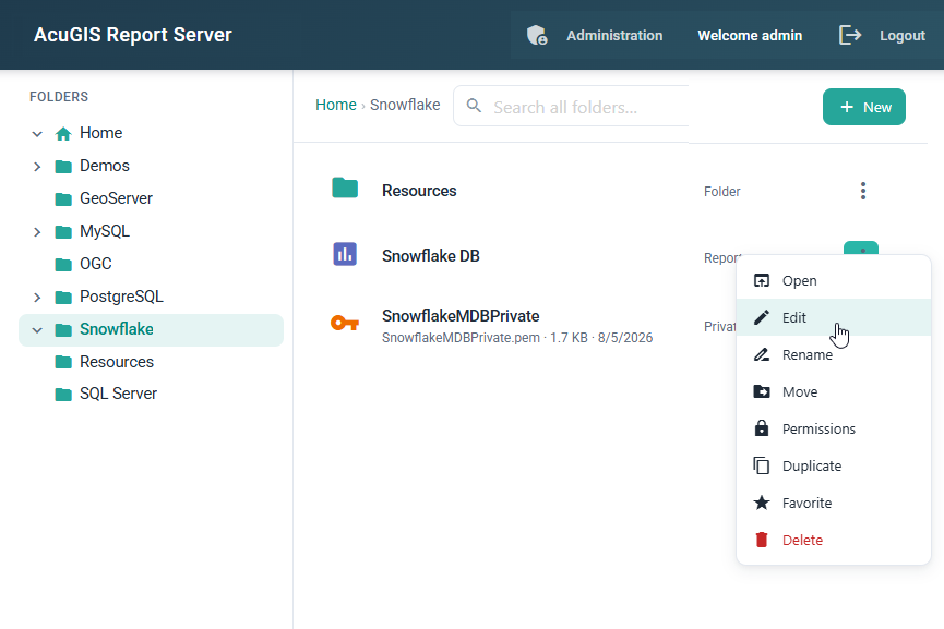
AcuGIS Report Server dashboard interface showing automated report schedules and spatial map integration
AcuGIS Report Server: Centralized spatial Jasper Reports generation & automated dispatch Status: Scheduled
Commercial Software Portfolio

Software Built for Real-World Applications.

Enterprise platforms engineered to automate complex spatial data flows, deliver mission-critical managed hosting, and generate high-impact reporting.

AcuGIS Logo
Managed Infrastructure & Cloud

AcuGIS

High-Performance Geospatial Hosting & Managed Services.

AcuGIS delivers dependable, fully managed cloud infrastructure purpose-built for spatial databases and GIS server engines. Organizations rely on AcuGIS for production deployments of PostGIS, GeoServer, QGIS Server, and spatial web services with expert support and automated operations.

  • Optimized runtime environments for PostGIS, GeoServer, and QGIS Server
  • Automated snapshots, continuous monitoring, and proactive maintenance
  • Scalable server configurations backed by dedicated commercial SLA support
AcuGIS Platform Management
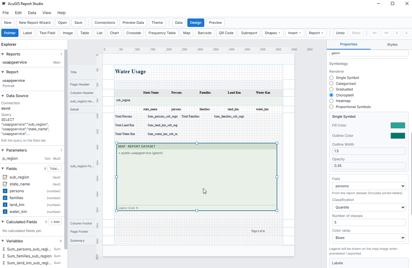
AcuGIS Report Designer and spatial infrastructure interface
GeoJibe Logo
Data Integration & Automation

GeoJibe

Geospatial Data Automation and Workflow Pipelines.

GeoJibe connects, transforms, and delivers geospatial data across enterprise applications, databases, and third-party APIs. By automating repetitive ETL pipelines without complex custom programming, GeoJibe ensures your spatial records stay synchronized and reliable.

  • Codeless workflow builder for complex spatial transformations
  • Real-time webhook and scheduled batch synchronization pipelines
  • Bi-directional connectors for GIS servers, relational databases, and REST APIs
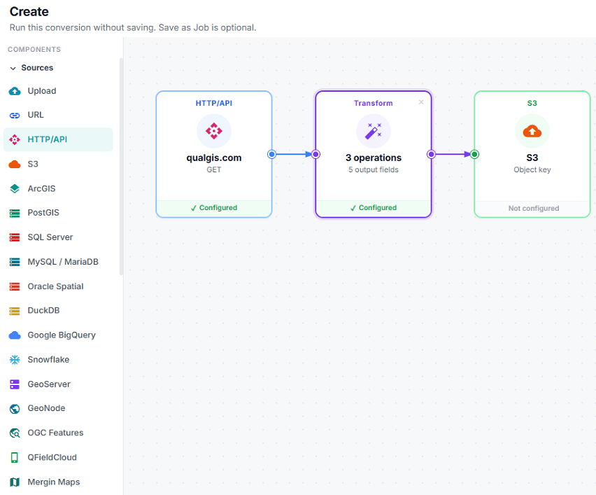
GeoJibe Pipeline Builder
GeoJibe visual workflow editor and data automation canvas
Report Server Logo
Reporting & Analytics

AcuGIS Report Server

Centralized Spatial Reporting and Automated Delivery.

AcuGIS Report Server is a purpose-built enterprise reporting solution designed to publish, schedule, parameterize, and email pixel-perfect Jasper Reports. Connect spatial data directly to operational summaries and distribute automated reports across your enterprise.

  • Automated generation and scheduled email delivery of PDF and Excel reports
  • Native integration with PostGIS spatial layers, tables, and maps
  • On-demand report execution with custom parameter filtering and access control
Report Server Administration Console
AcuGIS Report Server user interface showing scheduled reports and execution controls
Technical Expertise

From Data Integration to Insight.

Our engineering spans the complete geospatial stack — connecting systems, automating transformations, and powering dependable production deployments.

Data Integration & Automation

Automated Pipelines & Sync

Connect disparate databases, REST endpoints, and spatial repositories into unified, automated data pipelines. Eliminate manual reformatting and keep enterprise systems synchronized in real time.

Spatial ETL REST APIs Event Triggers Scheduled Sync

Reporting & Analytics

Automated Delivery & BI

Transform raw tabular and spatial records into structured, executive-ready reports. Automate recurring distribution across PDF, Excel, and web endpoints with granular access controls and parameters.

Jasper Reports Automated Email Spatial Maps PDF/Excel Export

Geospatial Applications

Web Mapping & Spatial Portals

Design and deploy responsive web mapping portals, spatial query interfaces, and standards-compliant spatial data delivery systems. Built on proven open standards including OGC, PostGIS, and QGIS.

QGIS Web Portals OGC WMS/WFS Vector Tiles GeoServer

Infrastructure & Deployment

Managed Hosting & Systems

Architect and manage scalable infrastructure tailored for data-intensive spatial systems. From automated Apache Tomcat and PostGIS provisioning to Nagios monitoring and backups, we ensure continuous availability.

Managed Cloud High Availability Nagios Telemetry Apache Tomcat
Open Standards

Built on Open Standards. Committed to Open Source.

CitedCorp actively builds on, contributes to, and maintains open-source projects for the global geospatial community. Open foundations ensure technological sovereignty, transparent architectures, and lasting interoperability.

Our open-source projects provide accessible, production-ready tools that organizations can freely inspect, deploy, and maintain. By contributing to open standards, we foster an interconnected ecosystem where commercial solutions and community software reinforce one another.

View Open Source Directory

QCarta

QGIS Web

Complete GeoPortal for QGIS Maps. Upload QGIS projects directly via plugin or FTP to launch instant, interactive spatial maps.

GeoExhibit

Spatial Exhibits

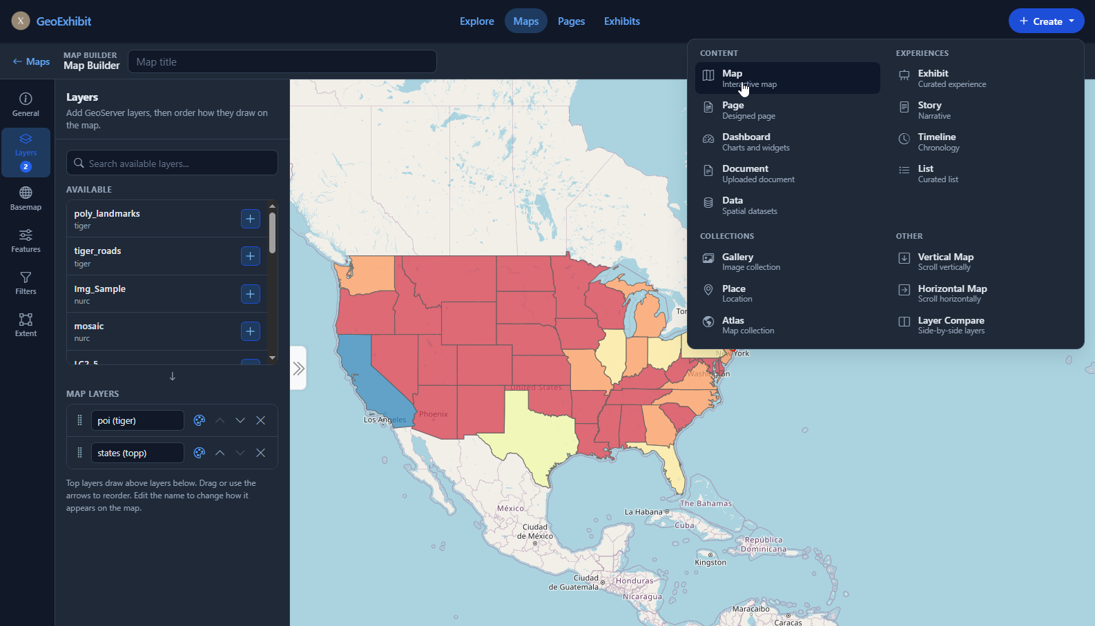
Flexible, standards-aligned platform for creating, presenting, and preserving spatially rich digital exhibits and interactive narratives.

Report Server

Jasper Reports

Publish, schedule, and email Jasper Reports. Run operational reports on demand and automate document distribution.

Server Modules

Tomcat & Nagios

Webmin modules to install, configure, and manage Apache Tomcat instances and Nagios network monitoring with NRPE agents.

About CitedCorp

Practical Software. Real-World Experience.

Cited, Inc. develops and supports commercial software for organizations operating complex data, application, and geospatial infrastructure.

We believe technology creates the greatest value when systems are interoperable, dependable, and architected around real-world operational challenges rather than walled gardens.

Engineering Rigor

Production-tested code designed for high concurrency, fault tolerance, and data integrity across intensive enterprise workloads.

Open Interoperability

Built natively on open geospatial standards (OGC, PostGIS, SQL) to eliminate lock-in and connect seamlessly with legacy and modern stacks.

Deployment Flexibility

Deploy with complete freedom — across on-premises infrastructure, private clouds, or fully managed enterprise cloud hosting.

Commercial Support

Production SLA backing, proactive security patching, dedicated engineers, and custom integration services for mission-critical operations.